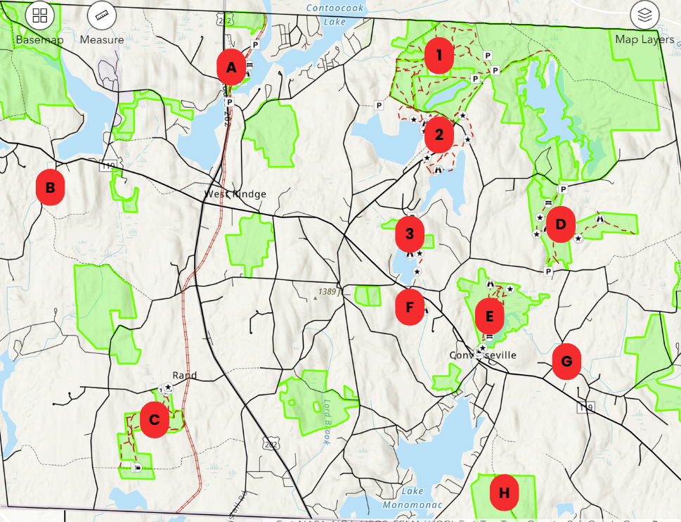
G. Ford Family Nature Preserve, North Street (no trails)
H. Sandback Wilderness, Bush Hill Road (no trails)
Other Conservation Areas/Trail Systems in Rindge (click on area name to scroll to individual map, below)
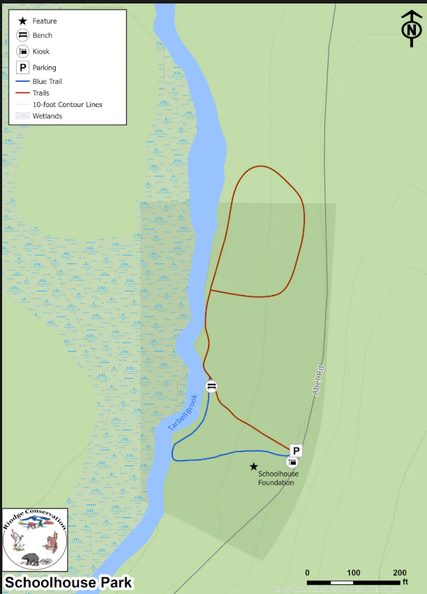
Description: Short trail down to a lovely brook.
Trail Length: .3 miles
Difficulty: Easy
Conservation Area: 6 acres
Location: Abel Rd, about 1.5 miles west on NH-119 from intersection with US-202.
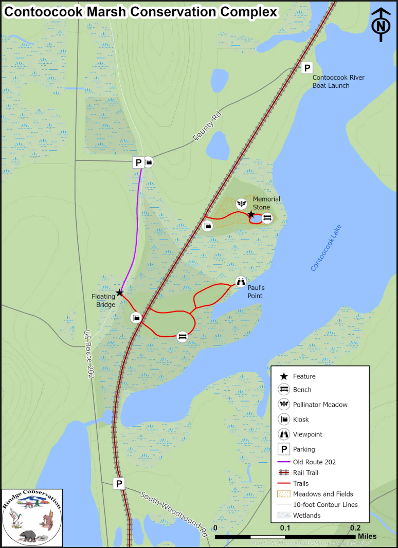
Location: County Rd, about 1.5 miles north on US-202 from intersection with NH-119
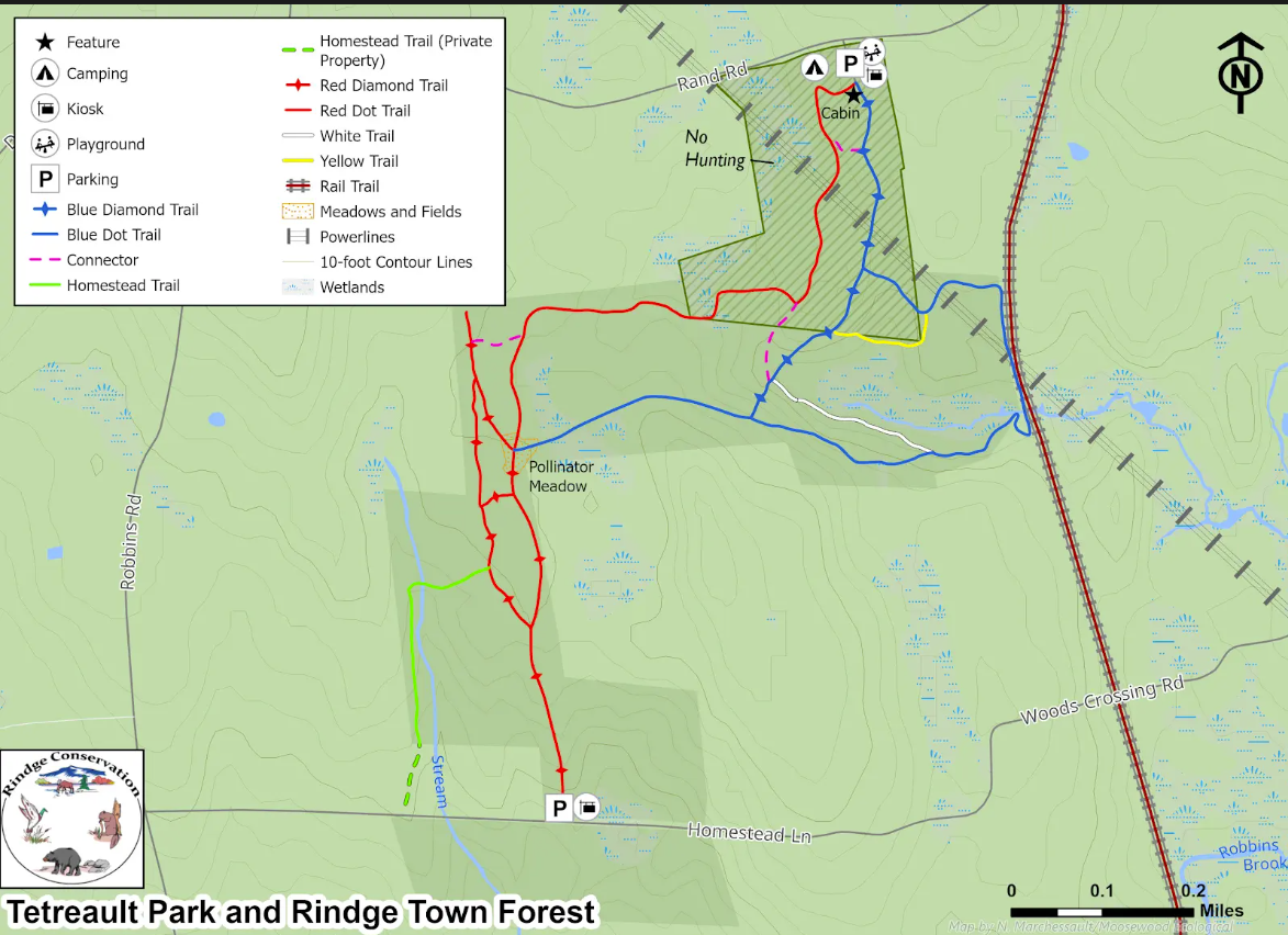 Description
: Tetreault Park and abutting Town Forest form a network of old logging trails and footpaths through trees, meadows, and uplands. Trails are appropriate for walking, horseback riding, snow shoeing, nature study, and birding. Park features a log cabin, tent platforms, and access to the rail trail. A natural playscape for children is located near the entrance.
Trail Length: 3.87 miles
Difficulty: Easy-Moderate
Conservation Area: Tetreault: 33 acres; Town Forest: 115 acres
Location: Rand Rd about 1.8 miles south on US-202 from intersection with NH-119.
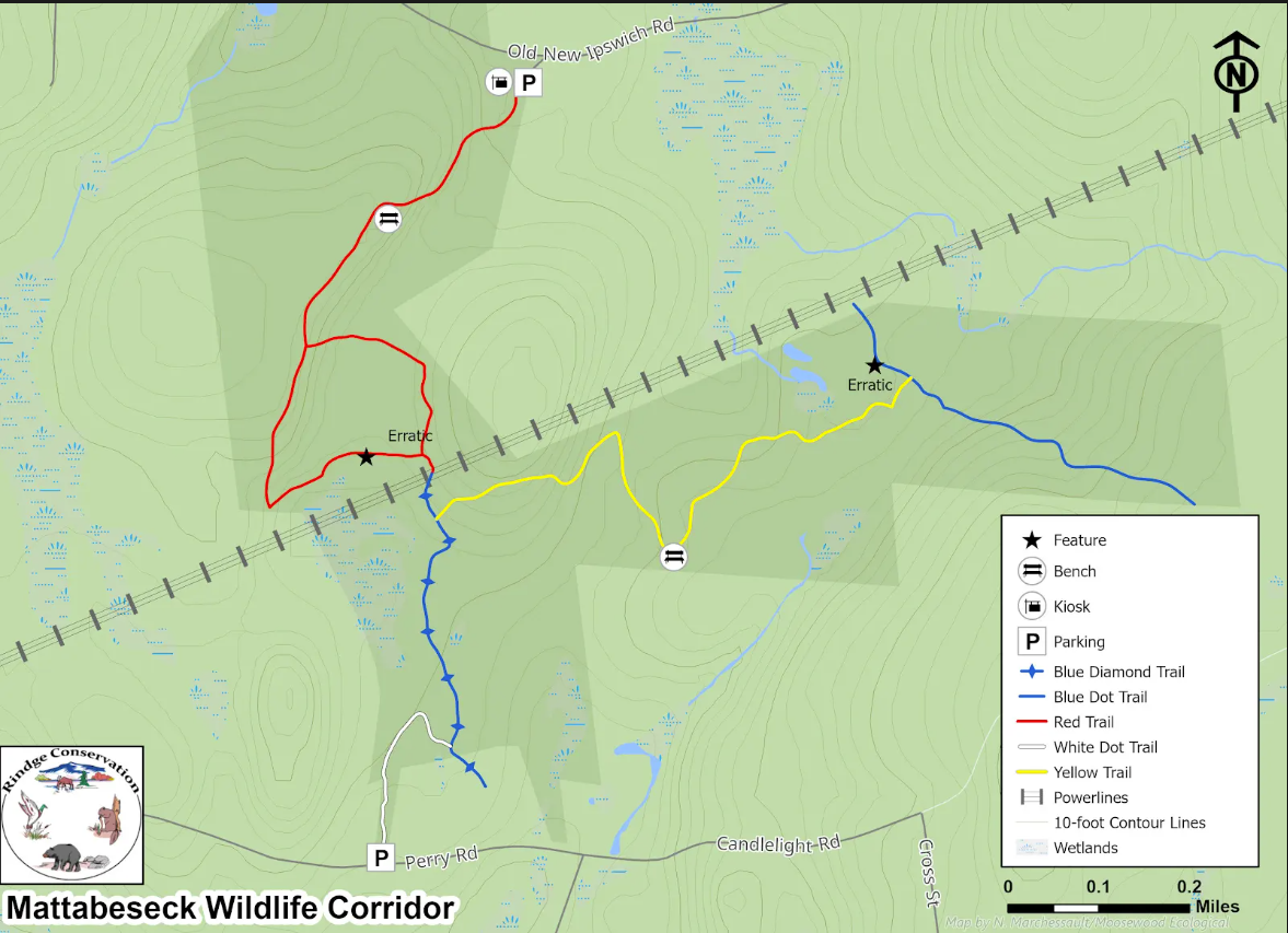 Description
: Trails feature diverse habitats, including mixed hardwood forests, rocky terrain, wetlands, and meadows. Many vernal pools are documented, as well as sightings of deer, moose, turkey, bear, bobcat, red and gray fox, fisher, beaver, turtles, and more. Trails vary in difficulty from stretches appropriate for easy walking or cross-country skiing to those more suited to rugged walking and snowshoeing.
Trail Length: 2.91 miles
Difficulty: Easy-Moderate
Conservation Area: 230 acres
Location: Old New Ipswich Rd, about 3.5 miles east on NH-119 from intersection with US-202. Follow Old New Ipswich Road for 2.3 miles north to parking area on right.
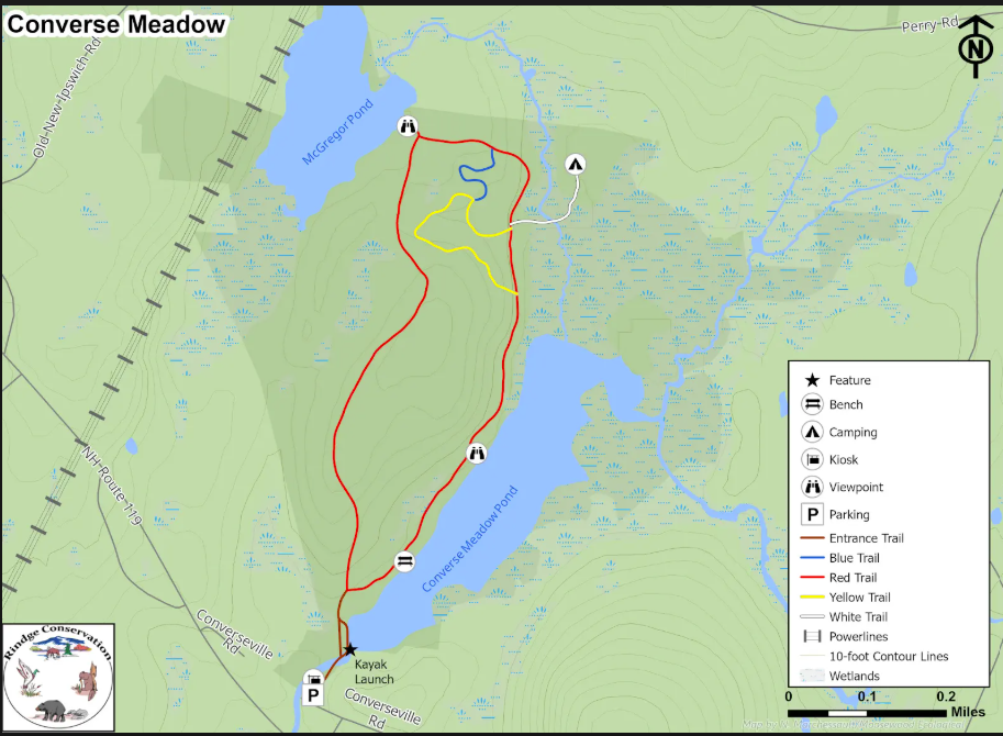
Description: Trails wind through hemlock and hardwood groves adjacent to Converse Meadow and McGregor Ponds, affording views of beautiful open wetlands. Spur trails pass over a footbridge leading to a canoe launch, offering dyllic views into the marshes, and access a tent site. A historic mill site predating revolutionary times is near the parking area.
Trail Length: 2.3 miles
Difficulty: Easy
Conservation Area: 240 acres
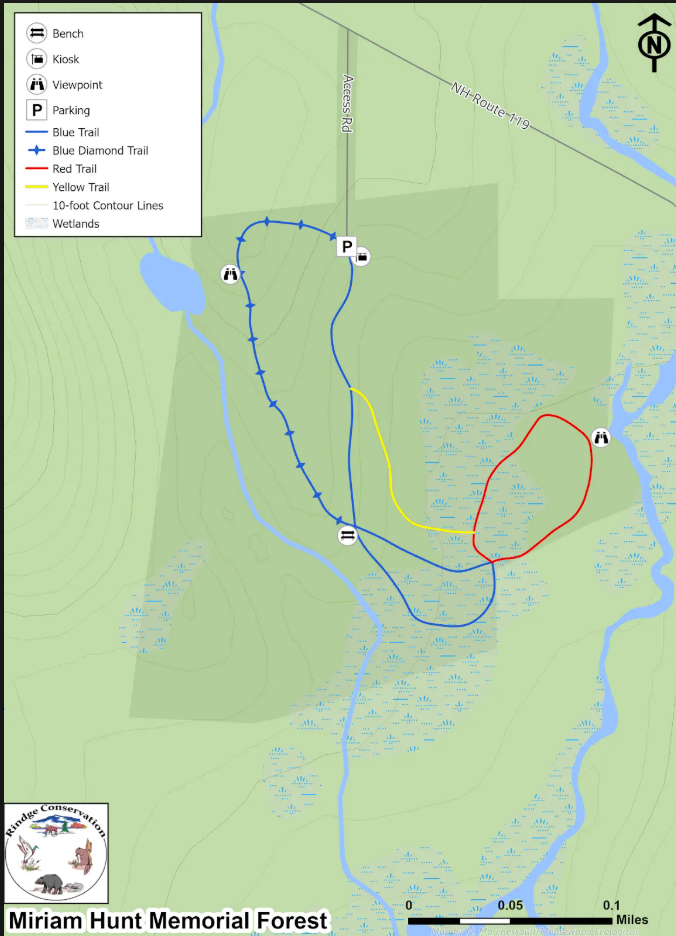
Location: Converseville Rd, about 2.8 miles east on NH-119 from intersection with US-202.
Description: Wide grassy trails loop through a mixed forest providing a view across wetlands. Ideal hiking location for families and school groups.
Trail Length: .85 miles
Difficulty: Easy
Conservation Area: 30 acres
Location: About 2.5 miles east on NH-119 from intersection with US-202, diagonally across from Cutter Hill Rd.
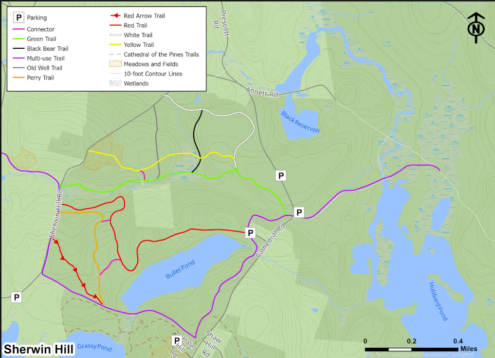
Description: An extensive network of woodland trails stretching across tracts owned by Annett State Forest, the Jaffrey's Bullet Pond Reservoir, and the Society for the Protection of NH Forests (Perry Forest I and Beulah Land). At the top of Sherwin Hill, there are broad fields hayed during the summer with views of the surrounding hills.
Trail Length: 8.6 miles
Difficulty: Easy-Moderate
Conservation Area: Annett State Forest: 1038 acres; Bullet Pond Reservoir: 138 acres; Perry I: 75 acres; Buleah Land: 39 acres
Location: Cathedral Road, about 1.6 miles east on NH-119 from intersection with US-202. Follow Cathedral Road for ~2+ miles northeast to parking areas.
![]()
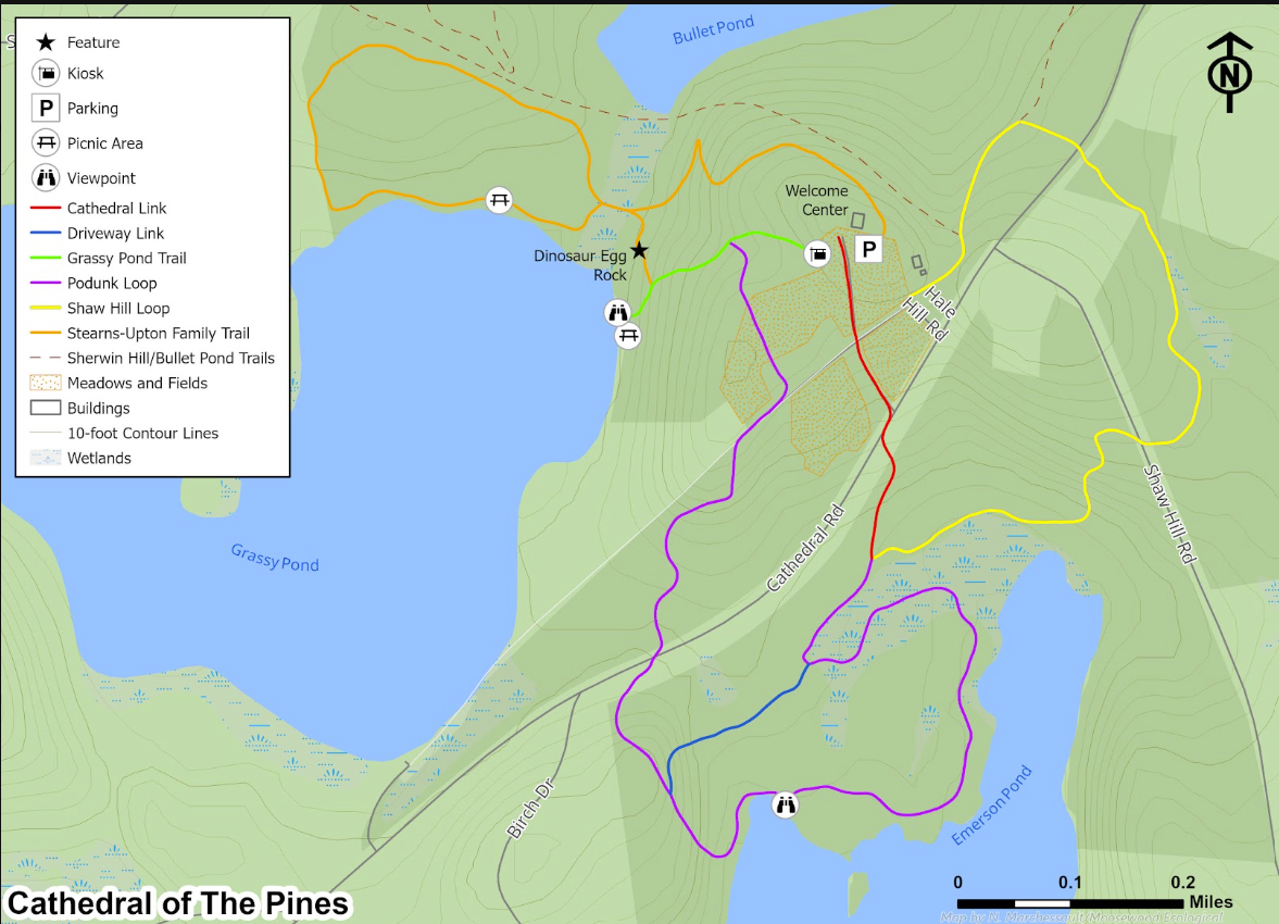
Description: Multiple connected loops in the "interlochen" campus of Cathedral of the Pines nestled between Grassy, Bullet, and Emerson Ponds.
Trail Length: 4.2 miles
Difficulty: Easy-Moderate
Conservation Area: Cathedral of the Pines: 236 acres
Location: Cathedral Road, about 1.6 miles east on NH-119 from intersection with US-202. Follow Cathedral Road 1.6 miles northeast.
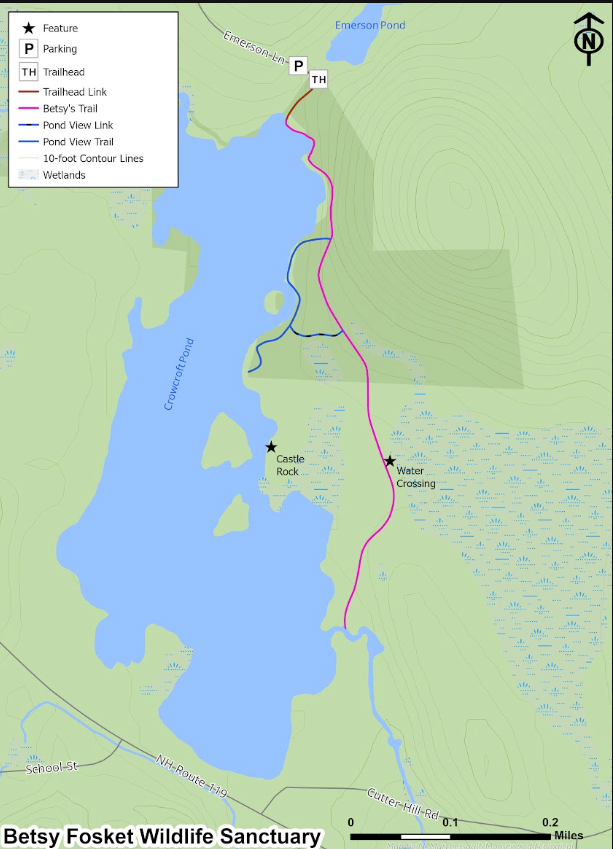
Description: Shoreline trail along Crowcroft Pond, with a woodland trail extending to a bridge crossing the pond outlet just downstream of the the pond dam.
Trail Length: .83 miles
Difficulty: Easy
Conservation Area: NH Audubon's Betsy Fosket Wildlife Sanctuary: 38 acres
Location: Cathedral Road, about 1.6 miles east on NH-119 from intersection with US-202. Follow Cathedral Road .5 miles northeast to right onto Birch Drive and then first right onto Emerson Lane.